
Cutting-Edge Tools
and Technologies
Cutting-Edge Tools
and Technologies
Cutting-Edge Tools
and Technologies
Cutting-Edge Tools
and Technologies
Cutting-Edge Tools
and Technologies
Cutting-Edge Tools
and Technologies
Cutting-Edge Tools
and Technologies
Cutting-Edge Tools
and Technologies
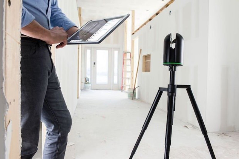
Laser Scanning
Revolutionize Data Collection with Laser Scanning
Laser scanning technology is revolutionizing data collection by offering precise 3D data capture capabilities. It provides numerous advantages, including rapid data acquisition, high precision, and detailed spatial information. Whether for architectural design, industrial modelling, or archaeological preservation, laser scanning technology allows for more accurate and comprehensive data collection. With our expertise in laser scanning, we enable you to unlock these advantages, improving the quality of your projects and decision-making. Embrace the future of data collection and experience the transformative power of laser scanning.
Technology
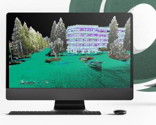
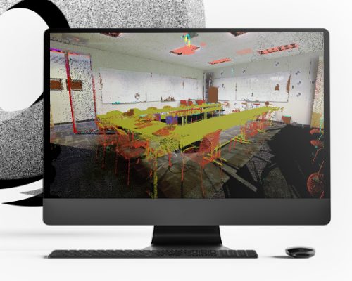
Point Cloud Processing
Efficient Point Cloud Processing with Cyclone
Cyclone is a software solution designed for efficient point cloud processing and modelling. It's widely used in industries such as architecture, engineering, construction, and surveying to manage and manipulate point cloud data captured through technologies like laser scanning. Cyclone allows users to register, clean, analyse, and model point cloud data, enabling the creation of detailed 3D models and accurate measurements. This software streamlines the handling of large and complex point cloud datasets, making it an essential tool for projects that require precision and spatial data analysis.
Technology
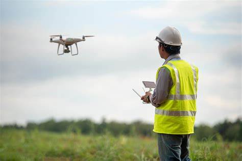
Drones
High-Flying Precision with Drones
Drones are soaring to new heights, transforming data collection and mapping with cost-effective and efficient solutions. These aerial vehicles offer several advantages, including rapid data acquisition, high-resolution imagery, and accessibility to hard-to-reach areas. Whether it's for land surveying, agriculture, or environmental monitoring, drones revolutionize the way we capture and analyse spatial data. With our drone services, you can harness this technology's potential to achieve precise results, reduce costs, and expedite project timelines. Discover how high-flying precision with drones can elevate your data collection and mapping efforts.
Technology
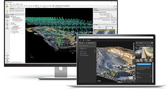
Photogrammetric Image Processing
3D Mapping and Modelling with Pix4D
Pix4D is a leading software solution that revolutionizes 3D mapping and modelling by transforming aerial imagery into detailed 3D models and maps. Using photogrammetry techniques, Pix4D processes images captured from drones or other aerial platforms to create accurate and high-resolution 3D representations of terrain, buildings, and objects. This technology has widespread applications in industries like agriculture, construction, surveying, and environmental monitoring, where precision and visualizing spatial data are crucial. By utilizing Pix4D, you can unlock the power of aerial imagery for enhanced analysis, planning, and decision-making in various fields.
Technology
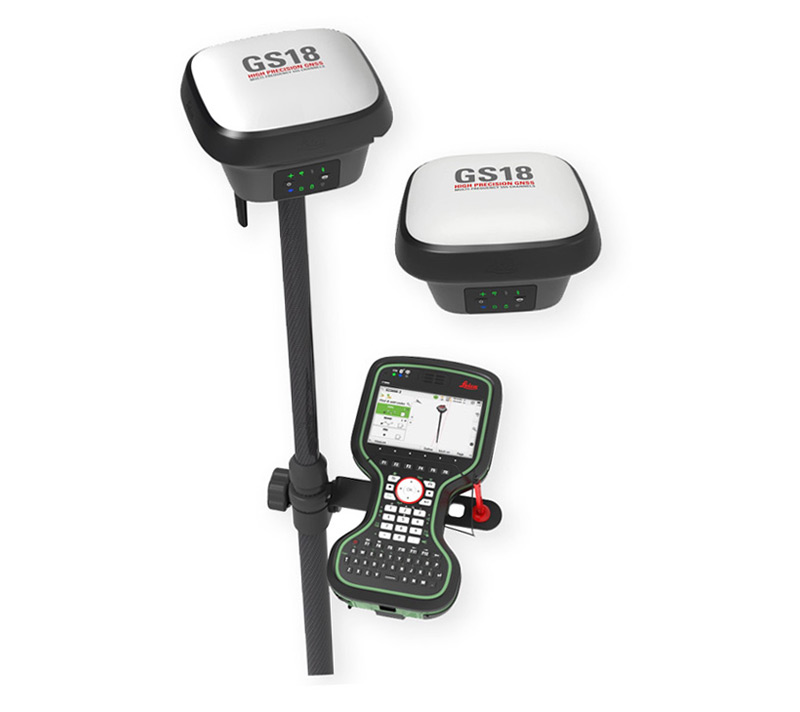
Global Navigation Satellite Systems
Navigate with Precision
Global Navigation Satellite System (GNSS) technology is a game-changer in achieving accurate positioning and navigation. GNSS systems, like GPS, Galileo, and GLONASS, utilize a network of satellites to provide precise location information for various applications. Whether it's for aviation, maritime, land-based navigation, or even geospatial data collection, GNSS ensures accurate and reliable positioning. Embrace the power of GNSS to navigate with precision, enhancing safety, efficiency, and decision-making in a wide range of industries and activities.
Technology
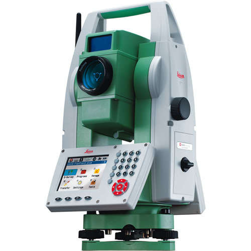
Land Surveying
Total Stations for Land Surveying
Total stations are vital instruments in land surveying, offering precise measurement of angles and distances. Their applications span diverse fields, from topographic surveys and construction layout to boundary determination and structural monitoring. These devices facilitate accurate data collection for agricultural mapping, environmental monitoring, and mining operations. Total stations are indispensable tools in achieving high-precision measurements, ensuring that projects in engineering, construction, and scientific research are executed with accuracy and efficiency.
Technology
Design and Drafting
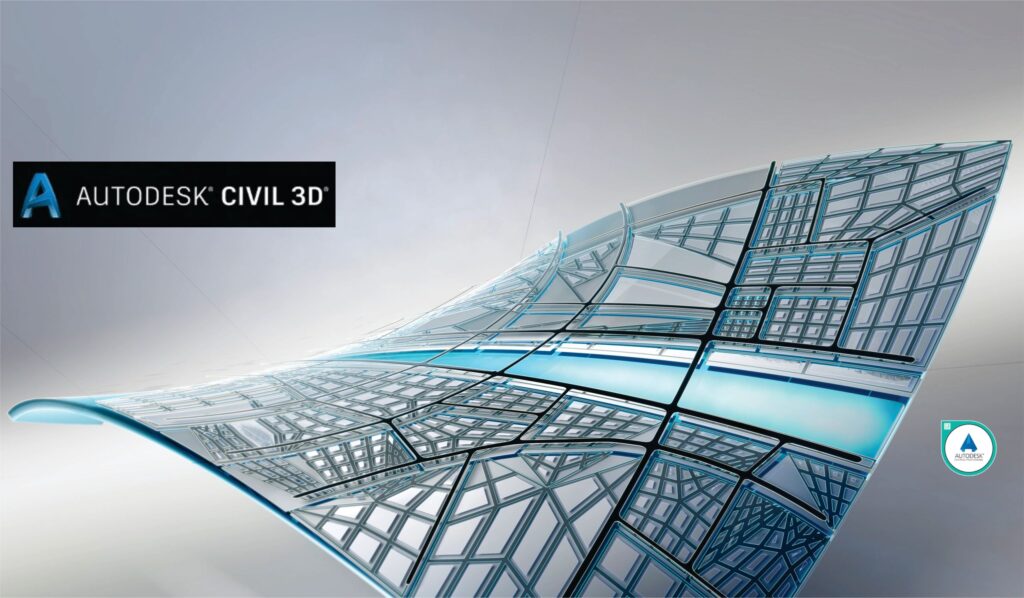
Design and Drafting with Civil 3D and AutoCAD
AutoCAD and Civil 3D are indispensable tools in precision surveying and engineering design. AutoCAD offers versatile 2D and 3D drafting and design capabilities, while Civil 3D extends these functions to civil engineering and surveying tasks. They streamline land development, infrastructure design, and surveying, allowing for precise, data-driven decisions. With geospatial analysis and visualization features, these software solutions enhance project understanding and execution. AutoCAD and Civil 3D are cornerstones in modern engineering, ensuring accurate and efficient design processes and spatial data analysis.
Technology